Rhino to Google Earth
摘要: 從Rhino 4.0 匯出或是另存新檔成.KML和.KMZ的格式
內容:
背景
Rhino V4裡,我們在Rhino核心裡增加了一些工具可允許讓你的模型在地球的具體位置上定位。目的要確保Rhino core需要支援GIS,mapping,建築等等應用。
我們不斷的努力使Rhino提供最精確的建模。當Rhino繪圖模型空間(3D卡式座標)對比地球的緯度、經度和高度,會考慮到一個事實是地球不是圓的( http://en.wikipedia.org/wiki/Earth_radius ).
概要
去測試和證明這些新的Rhino功能,我們增加了一個簡單的Google Earth匯出之外掛程式。這個主意是匯出任何Rhino的模型為.KML或.KMZ file可以放在網站上,或E-mail給其他人那他們可以在Google Earth上觀看模型。
我們也提供一個方法去匯入.KML和.KMZ file到Rhino。(記得,有很多的KML/KMZ file沒有任何3D幾何。)
Google Earth 3D檔案格式是.KML(未壓縮)或.KMZ(壓縮過)。.KMZ file是簡單的;.KML file之壓縮與擴充更換.ZIP為.KMZ,想了解更多的.KML file格式和其他有幫助的連結,如下:
操作指南
匯出檔案,存檔等等
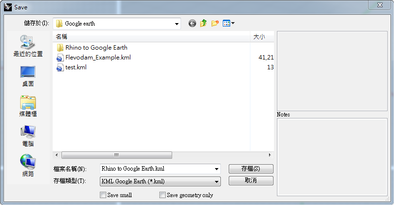
從另存新檔中之存檔類型中選擇KML(圖1)。選擇一個檔案名稱和儲存位置。這將會創造一個.KML file且藉由壓縮和重新命名(.ZIP到.KMZ)可轉換成一個.KMZ file。
KML和KMZ 檔案格式可以發表像其他網站相容的類型(html,jpg,gif等等),但是你的網站伺服器需能認識KML和KMZ 檔案格式。詳細如下:http://www.keyhole.com/kml/kml_tut.html#kml_server
繪製Google Earth模型的要點
- 利用EarthAnchorPoint指定模型在地球上的地位錨點
- 在建模的尺寸單位裡作業,像公尺(你可以在你任何想要的單位系統裡作業,但不要指望能夠在Google Earth裡看到一公分大小的耳環。)
- 設定Perspective view鏡頭為21mm。由Google Earth使用這種緊密匹配的攝影角度。
- 當你儲存Google Earth file時,確保你的物件在Perspective視窗裡看起來是在地平面以上。
- 以 Mesh 指令將曲面轉換為網格時模型的資料量會變大,請盡量減少網格面的數量。
- Google Earth 可以顯示物件的顏色。
- 您可以使用 Google Earth 開啟、編輯、儲存 KMZ 與 KML 檔,以加入其它非 3D 幾何圖形的資訊。
EarthAnchorPoint 指令
Rhino 4的新增指令, “EarthAnchorPoint”,設定錨點。 (這個指令是提供給所有地理資訊系統(GIS)及地圖應用程式(mapping aplication)相關地理位置資訊使用;並非特定給Google Earth使用)
此指令需提供三個設定的資訊。
- 地球上的位置
- 緯度(latitude)
- 經度(longitude)
- 高度(elevation above ground level)
- 模型的方位
- 指定模型與地球上的位置的錨點。
- 指定模型朝北的方向。
- 指定模型朝東的方向。
- 識別資訊 (可選填)
- 名稱。
- 描述。
- URL。
- URL標籤。
舉例,以下資訊包含McNeel and Associates的西雅圖總部之定位點:
- 定位點在地球上的位置
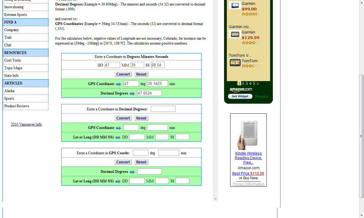
- 緯度: 47° 39' 08.54“N (輸入: 47.653395° 轉換 )
- 精度: 122° 20' 37.30”W (-122.34384°)
- 高度: 0 (建構模型在地平面上)
在海平面,經度一分大約為 6,000 英呎,一秒大約為 100 英呎,百分之一秒大約為 1 英呎。
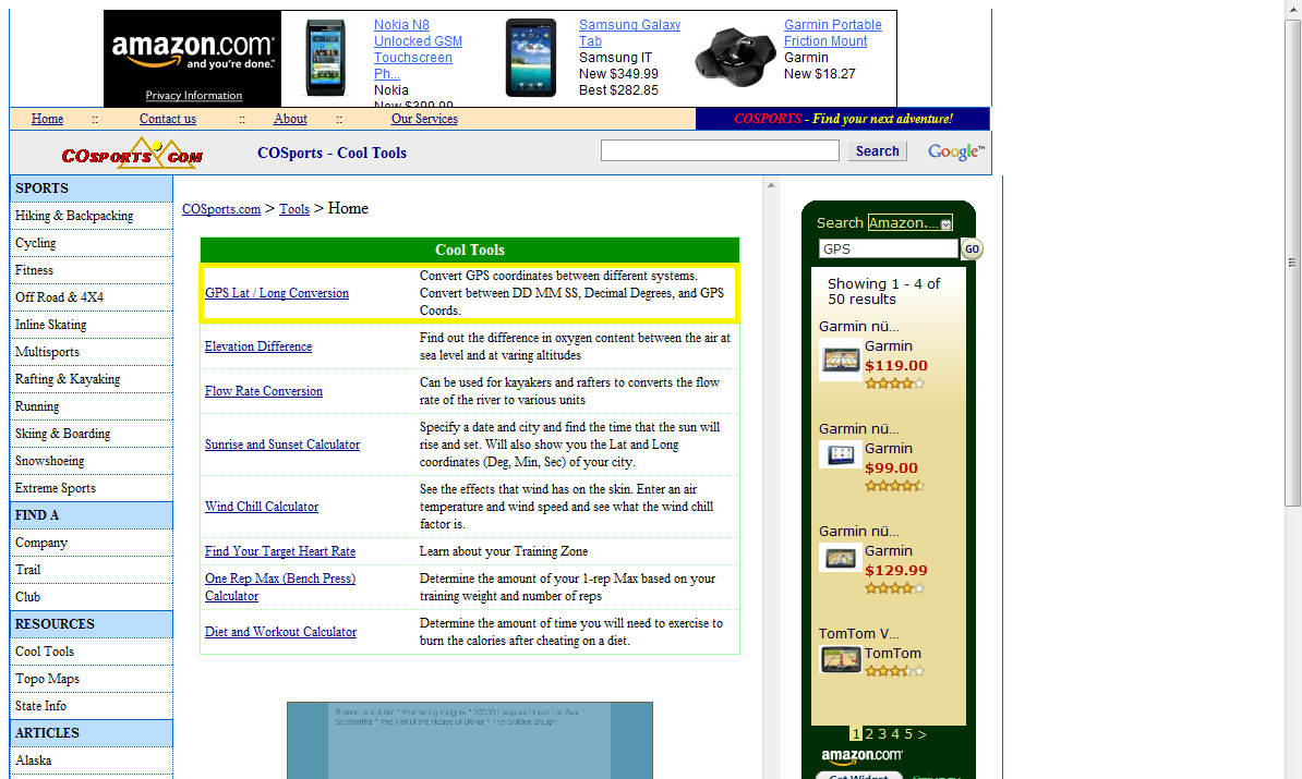
轉換器使用教學:
1.選GPS Lat/Long Conversion
 2.輸入’度分秒’點選convert轉換成’度’(經/緯度一樣的方法)
 更多關於經緯度說明
範例
下列為一些範例
教學
討論
附註: 我們需要從我們的使用者了解假如這個外掛程式是值得去調整的。Rhino也許是一個簡單的方法去匯出不同的檔案格式和複雜的圖形到Google Earth上呈現。但是…Google Earth file格式非常簡單所以模型看起來不會那麼棒。
這個對任何人有幫助嗎?假如如此,為什麼?
在我工作的行業目前並無幫助,但當我看見Manhattan New York在Google Earth上,我想這個有潛力,即便Google Earth他的建築物品質快速但色彩黯淡。
Gerard Petersen
Yes – We do a lot of work for State DOT's and this would be especially useful in the civil-structural arena where everyone wants to get a sense of scale for the project.
Reverse the idea and you have something just as interesting… Any way to export 3D building data from Google Earth into Rhino? If you are looking for an adventure, try Ogle.
It would help if picture files which have been mapped to surfaces could be exported as well. Our current workaround is to export the building geometry to SketchUp via an SKP file, texture the model there using pictures of the building, then place it in GE.
Yes this is extremely useful. I need to import kml files into rhino for large site models.

